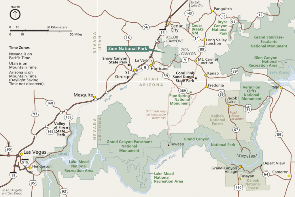
Are You Looking For Zion National Park Maps?

Zion National Park, located in southwestern Utah, is a popular destination for hikers, rock climbers, and nature enthusiasts. Zion spans over 146,000 acres and includes a variety of landscapes. The landscapes include deep canyons and towering cliffs, lush forests and cascading waterfalls. Because of this, there are several must-see things at Zion National Park. However, this post will focus on Zion National Park maps and why they are crucial to exploring the landscape.
One of the key tools for exploring Zion National Park is a map. There are several different maps available for the park, including park-wide maps, trail maps, and topographic maps. If you are interested in learning more about Zion National Park, you can explore rvResortScouts Zion listing. We have also crafted the Ultimate Guide to Zion National Park. This article will give you broad coverage of everything Zion has to offer.

Zion National Park Maps: Park Wide Map
The park-wide map is a comprehensive guide to Zion that provides an overview of the park’s layout and the location of the major attractions. It shows the park’s boundaries and its location within the state of Utah. The map also includes the major roads that lead to and through Zion, making it easy to plan your route and navigate the park’s winding roads.
In addition to the park’s roads, the map highlights the location of the park’s major attractions, including hiking trails, scenic drives, viewpoints, and picnic areas. This information is incredibly useful when planning your itinerary for your visit to Zion. Whether you’re interested in hiking to Angels Landing, exploring the Emerald Pools, or driving the Zion-Mount Carmel Highway, the park-wide map will help you find your way.
The map also includes information on park facilities, such as restrooms, picnic areas, and campgrounds. If you’re planning to spend the night in Zion, the map will help you locate the various campgrounds and RV sites within the park. The map also indicates the location of the visitor center, where you can get more detailed information about Zion’s attractions, services, and regulations.
Learn more about the parks’ transportation options in our article “Can You Drive into Zion National Park“.
Zion National Park Maps: Trail Map
The trail map is essential for hikers and other outdoor enthusiasts. It shows the locations of the various trails within Zion, as well as the difficulty level of each trail and the estimated time it takes to complete. The trail map also includes information on the distance between trails and the elevation gain or loss.
Map Zion National Park: Topographic Map
In addition to the park-wide and trail maps, topographic maps are also available for those who want more detailed information on the terrain. These maps show the elevation and contour lines of the land, making it easier to visualize the steepness of the trails and the relative height of the cliffs and peaks.
How to Obtain Zion National Park Maps
There are several ways to obtain maps of Zion National Park. The park’s official website, www.nps.gov/zion, has a variety of maps available for download, including park-wide maps, trail maps, and topographic maps. You can also pick up a map at the park’s visitor center, which is located at the south entrance of the park.
In addition to these maps, it’s also a good idea to bring a GPS device or a phone with GPS capabilities when exploring Zion. This can be helpful in case you get lost or need to find your way back to a specific location.
No matter what type of map you choose, it’s important to familiarize yourself with it before starting your trip. This will help you plan your route and ensure that you have a safe and enjoyable visit to Zion.
Here are some links to maps of the area:
- Park-wide map: https://www.nps.gov/zion/planyourvisit/upload/ZionNP_Map.pdf
- Trail map: https://www.nps.gov/zion/planyourvisit/upload/ZionNP_Trails.pdf
- Topographic map: https://www.nps.gov/zion/planyourvisit/upload/ZionNP_Topo.pdf
Utah State Map
You may also choose to view a full state-wide map of Utah. Doing so will give you an idea of where other National Parks, State Parks, and RV Resorts are located. You can check out a state wide map at utah.gov. We also suggest checking out Sand Hollow RV Resort if you will be in the area. It has some of the best golfing in the whole State.